Overnight
Sat, Oct 24
Low 53°F
Chance Rain Showers
Wind: SSE 7 mph
Precipitation chance: 11%
Forecast details
A chance of rain showers before 4am. Mostly cloudy, with a low around 53. South southeast wind around 7 mph.
Day and night forecasts from the National Weather Service for Plover.
NWS forecast updated Sat, Oct 24, 2:37 AM CDT
Sat, Oct 24
Chance Rain Showers
Wind: SSE 7 mph
Precipitation chance: 11%
A chance of rain showers before 4am. Mostly cloudy, with a low around 53. South southeast wind around 7 mph.
Sat, Oct 24
Partly Sunny
Wind: S 7 to 13 mph
Precipitation chance: 4%
Partly sunny. High near 71, with temperatures falling to around 69 in the afternoon. South wind 7 to 13 mph, with gusts as high as 22 mph.
Sat, Oct 24
Mostly Cloudy
Wind: SW 3 to 10 mph
Precipitation chance: 11%
Mostly cloudy. Low around 53, with temperatures rising to around 55 overnight. Southwest wind 3 to 10 mph, with gusts as high as 21 mph.
Sun, Oct 25
Mostly Cloudy
Wind: WNW 6 mph
Precipitation chance: 13%
Mostly cloudy, with a high near 66. West northwest wind around 6 mph.
Sun, Oct 25
Mostly Cloudy
Wind: NNE 5 mph
Precipitation chance: 4%
Mostly cloudy, with a low around 44. North northeast wind around 5 mph.
Mon, Oct 26
Mostly Cloudy
Wind: ENE 7 mph
Precipitation chance: 13%
Mostly cloudy, with a high near 53.
Mon, Oct 26
Mostly Cloudy then Slight Chance Rain Showers
Wind: E 9 mph
Precipitation chance: 21%
A slight chance of rain showers after 1am. Mostly cloudy, with a low around 36. Chance of precipitation is 20%.
Tue, Oct 27
Chance Rain Showers
Wind: ESE 12 mph
Precipitation chance: 26%
A chance of rain showers. Mostly cloudy, with a high near 56. Chance of precipitation is 30%.
Tue, Oct 27
Slight Chance Rain Showers
Wind: SE 6 to 12 mph
Precipitation chance: 16%
A slight chance of rain showers. Mostly cloudy, with a low around 45. Chance of precipitation is 20%.
Wed, Oct 28
Chance Rain Showers
Wind: S 6 to 13 mph
Precipitation chance: 38%
A chance of rain showers. Partly sunny, with a high near 66. Chance of precipitation is 40%.
Wed, Oct 28
Chance Rain Showers
Wind: SW 8 to 12 mph
Precipitation chance: 34%
A chance of rain showers. Partly cloudy, with a low around 44. Chance of precipitation is 30%.
Thu, Oct 29
Slight Chance Rain Showers then Mostly Sunny
Wind: W 8 to 12 mph
Precipitation chance: 15%
A slight chance of rain showers before 7am. Mostly sunny, with a high near 61. Chance of precipitation is 20%.
Thu, Oct 29
Partly Cloudy then Slight Chance Rain Showers
Wind: SW 1 to 7 mph
Precipitation chance: 21%
A slight chance of rain showers after 1am. Partly cloudy, with a low around 40. Chance of precipitation is 20%.
Fri, Oct 30
Chance Rain Showers
Wind: SSE 3 to 9 mph
Precipitation chance: 32%
A chance of rain showers. Partly sunny, with a high near 60. Chance of precipitation is 30%.
Source: NWS Plover 7-day forecast.
Snowfall and winter impacts from the National Weather Service office in Green Bay for central and northeast Wisconsin.
Winter graphics may be seasonal. Always check the dates on the map; a missing map does not mean that no snow is expected.
Select this section to load the map, or use the source link below.
Source: NWS Green Bay. Tap the map to enlarge. Check its printed issue and valid dates.
Select this section to load the map, or use the source link below.
Source: NOAA Weather Prediction Center. Tap the map to enlarge. Check its printed issue and valid dates.
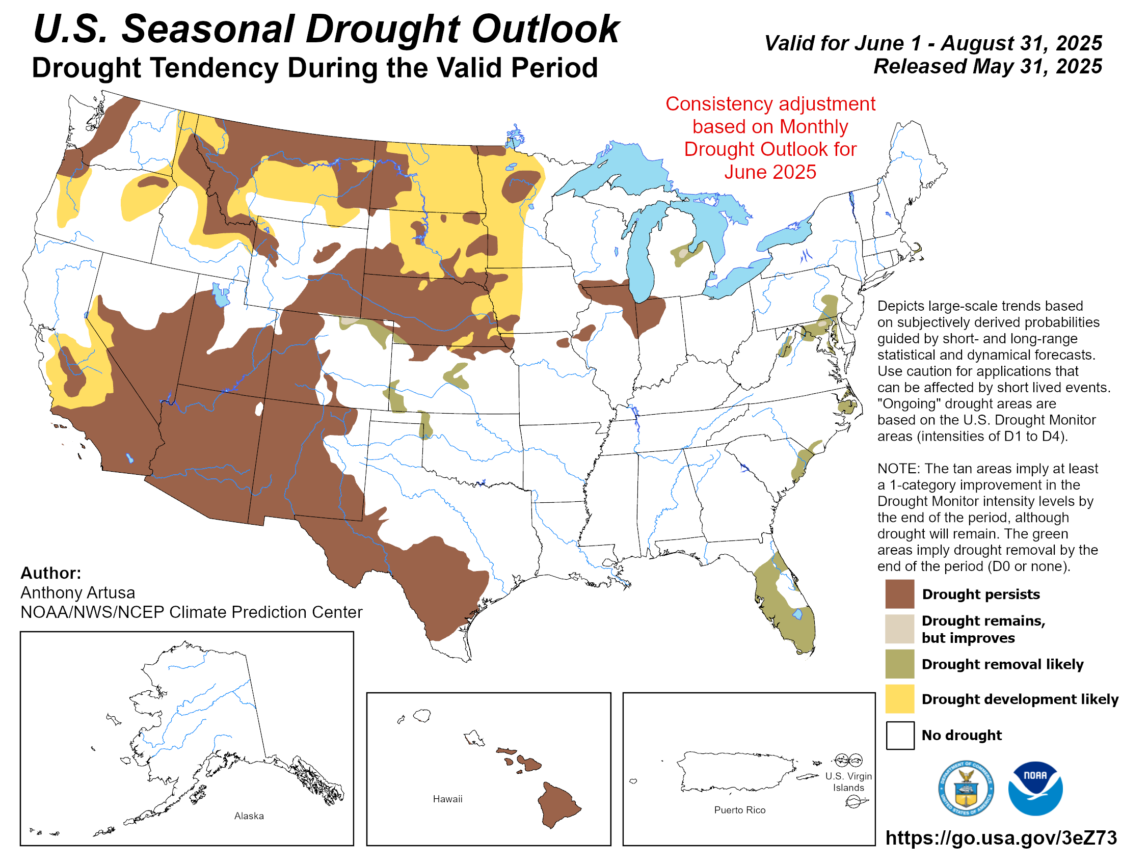
Compare Wisconsin's latest drought assessment with the outlook for drought improvement, persistence, or development.
Select this section to load the map, or use the source link below.
Source: U.S. Drought Monitor. Tap the map to enlarge. Check its printed issue and valid dates.
The Drought Monitor describes broad regional conditions. Conditions in an individual yard or garden may differ.
Select this section to load the map, or use the source link below.
Source: NOAA Climate Prediction Center. Tap the map to enlarge. Check its printed issue and valid dates.
Estimated fishing windows · Plover · Central Time
Blended colors show estimated windows—not measured fishing activity.
Select Fishing Forecast to load the six-day fishing times.
NWS weather updated Sat, Oct 24, 2:37 AM CDT
Plover Weather calculates two-hour major periods centered on the moon's upper and lower transit, and one-hour minor periods centered on moonrise and moonset for the selected city. Each period is listed on the date of its center; a date appears beside an endpoint when it crosses midnight. Some dates naturally have fewer events. These estimates do not account for fish species, water temperature, or local habitat and do not guarantee a catch.
Astronomical data from MET Norway, used under CC BY 4.0. Fishing-period estimates calculated by Plover Weather; they are not a fishing forecast issued by MET Norway.
Weather source: National Weather Service forecast for Plover. Check current alerts before heading onto the water.
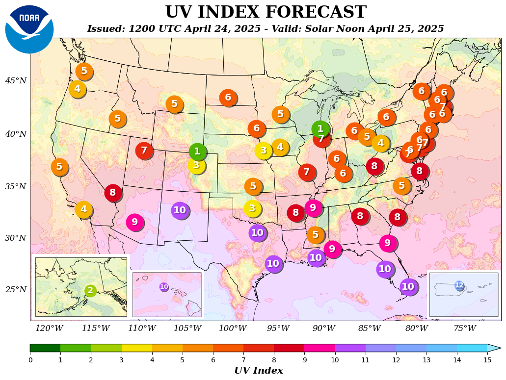
The NOAA UV forecast gives a regional picture of expected ultraviolet intensity. This national city map is not a measurement at the Plover Weather station.
Select this section to load the map, or use the source link below.
Source: NOAA Climate Prediction Center. Tap the map to enlarge. Check its printed issue and valid dates.
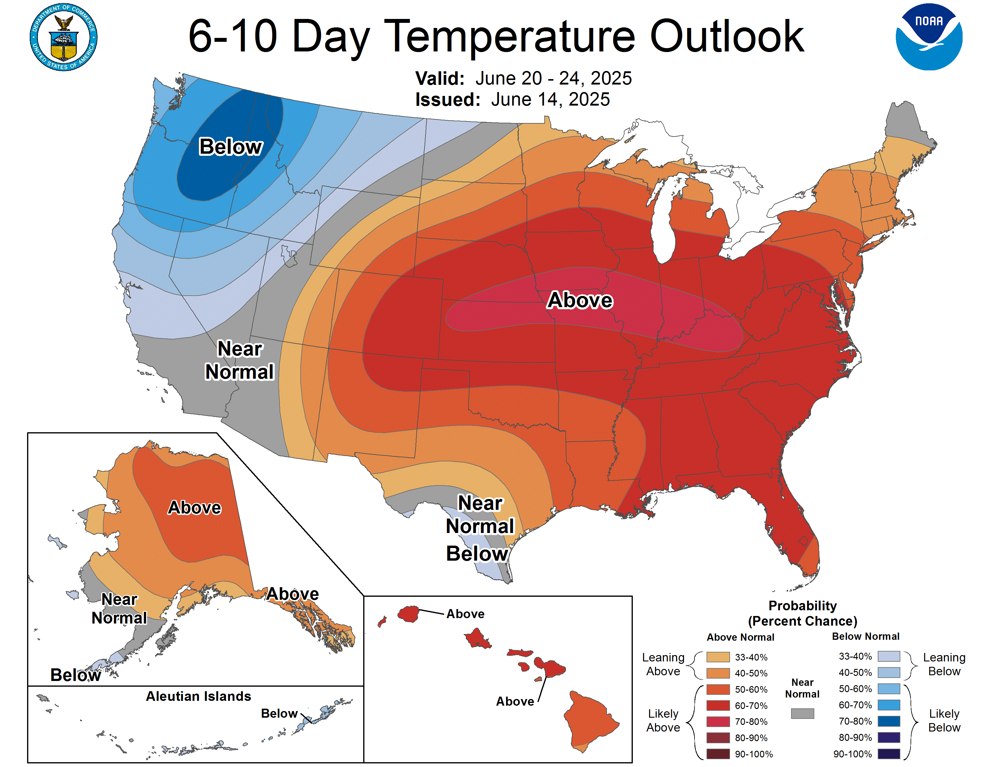
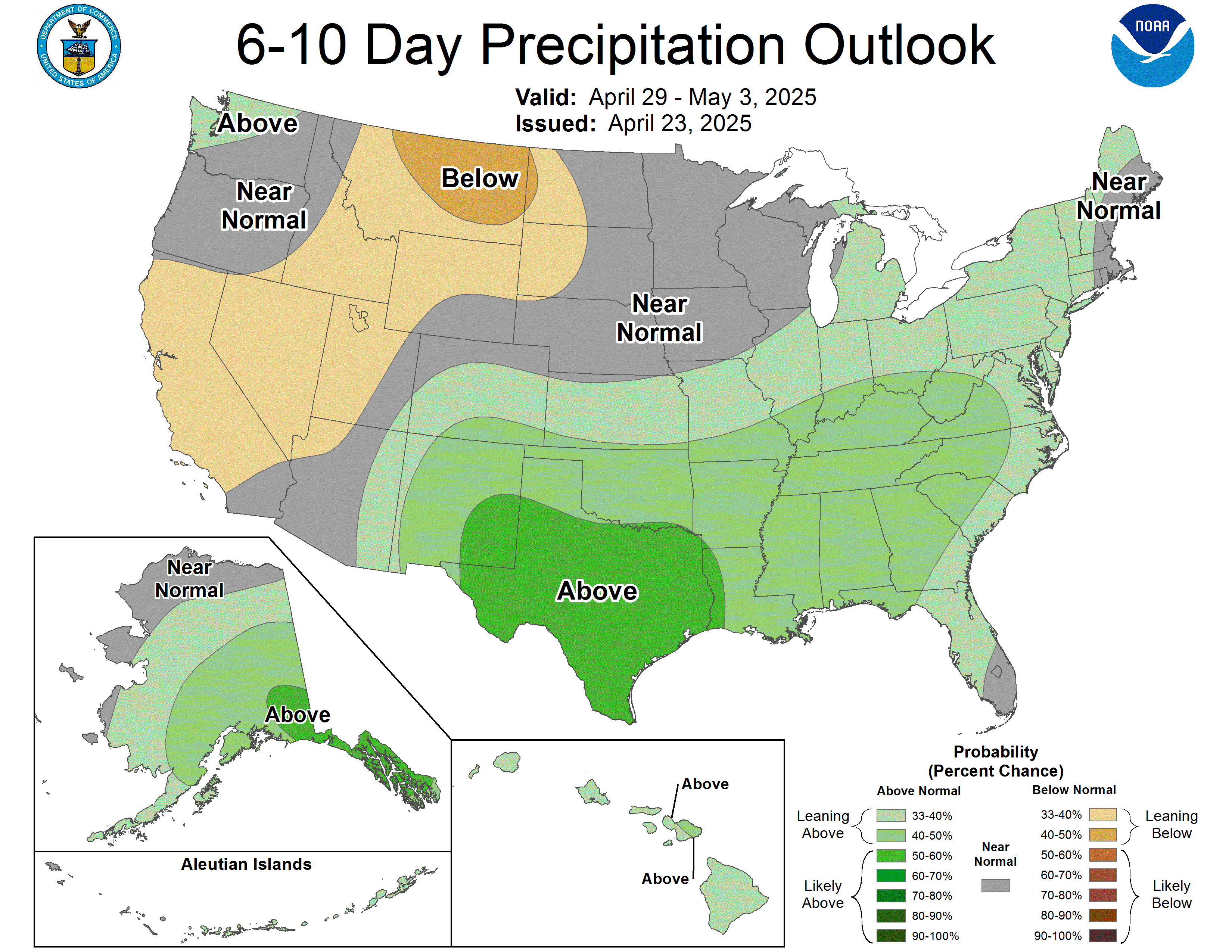
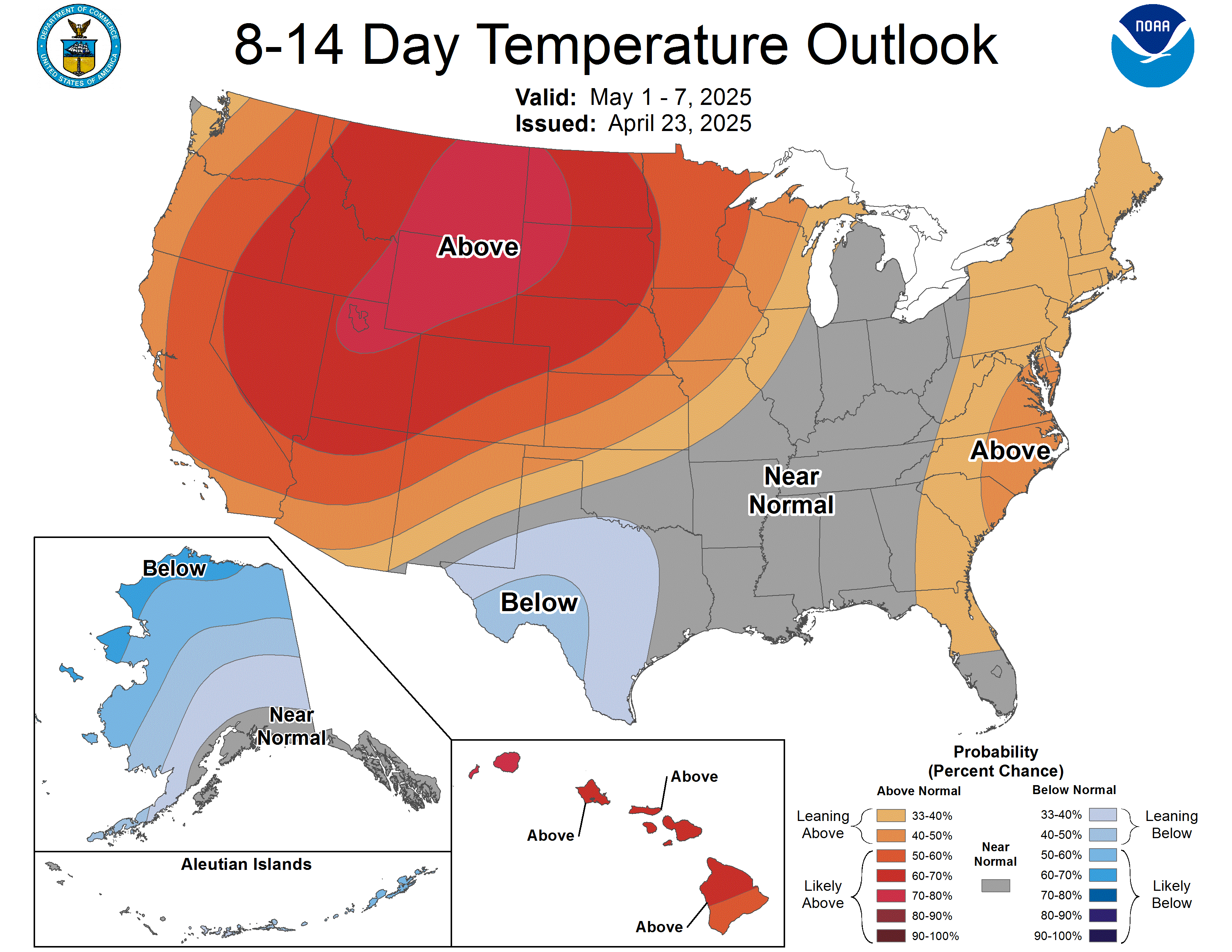
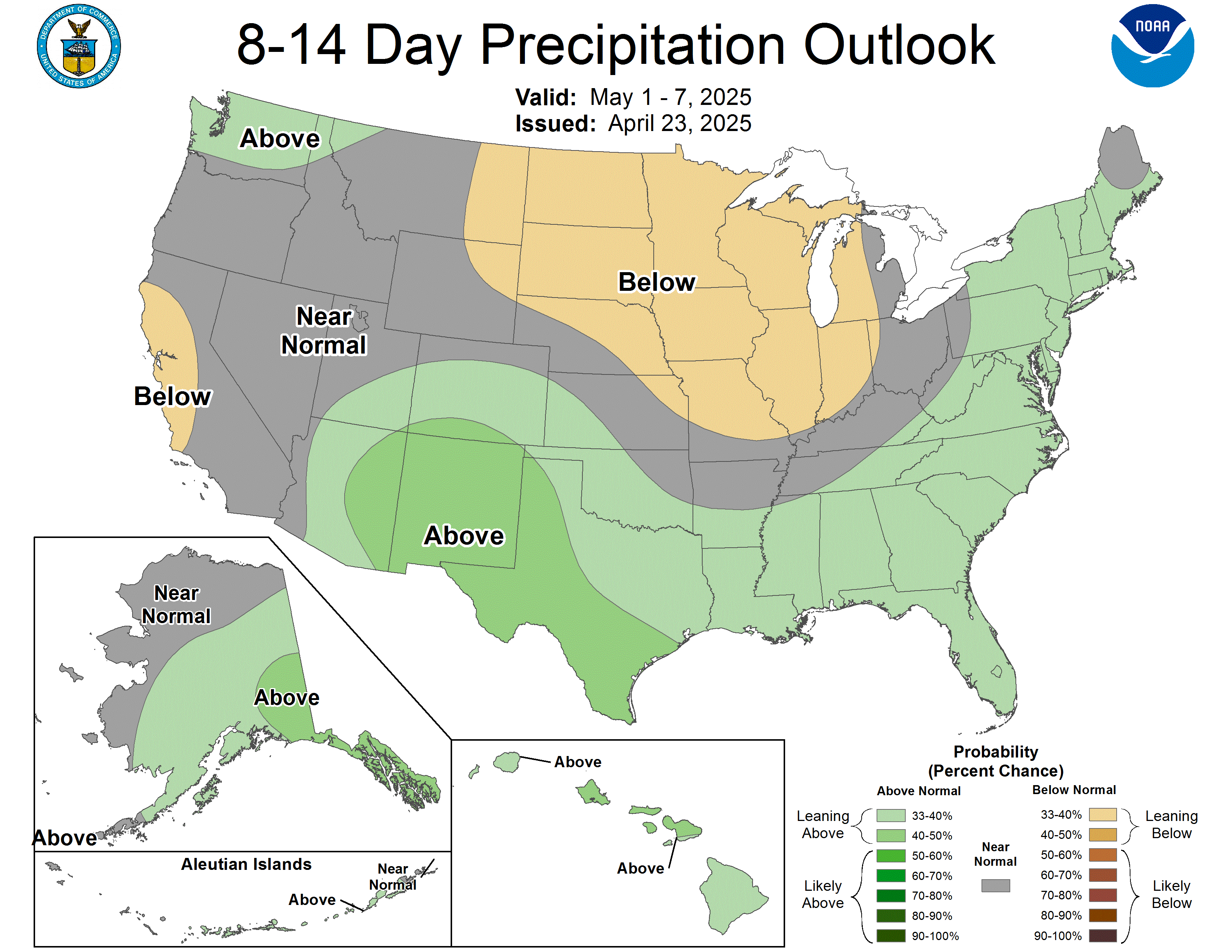
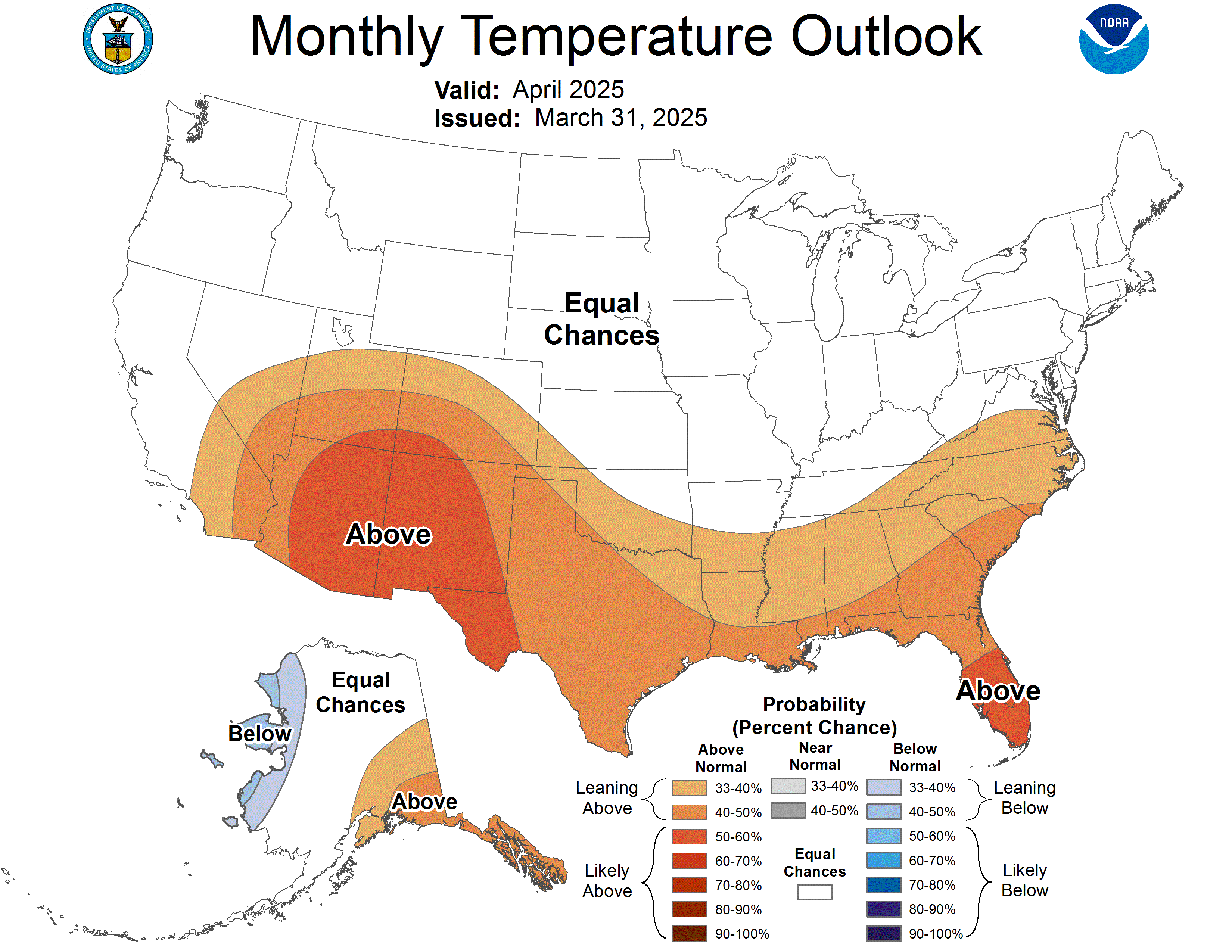
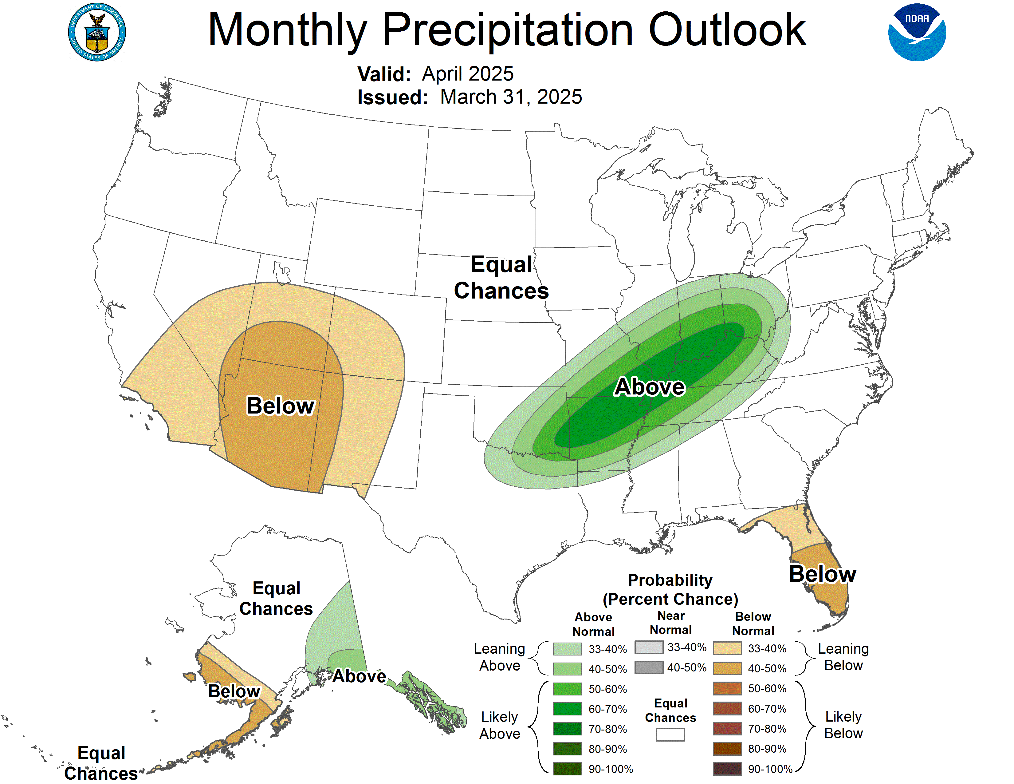
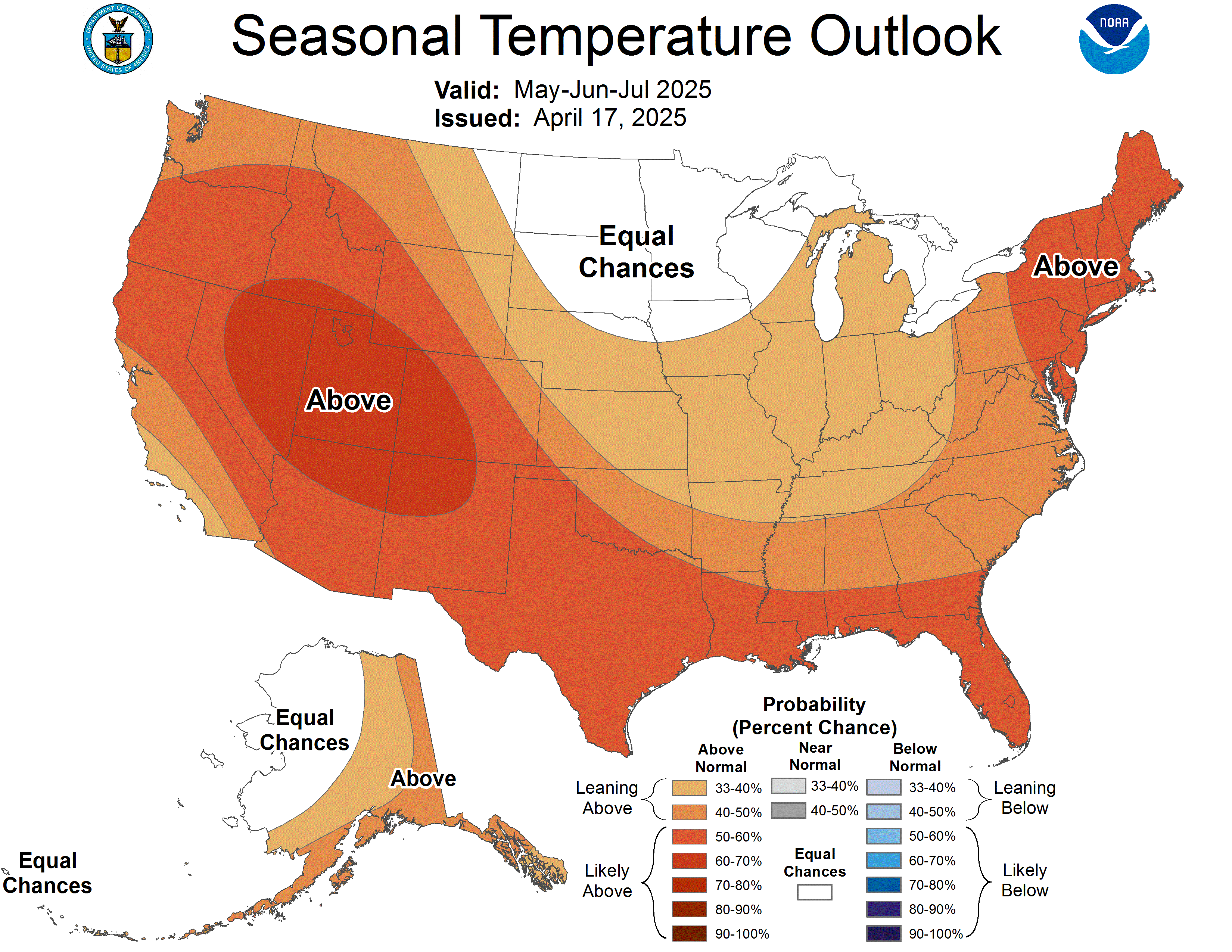
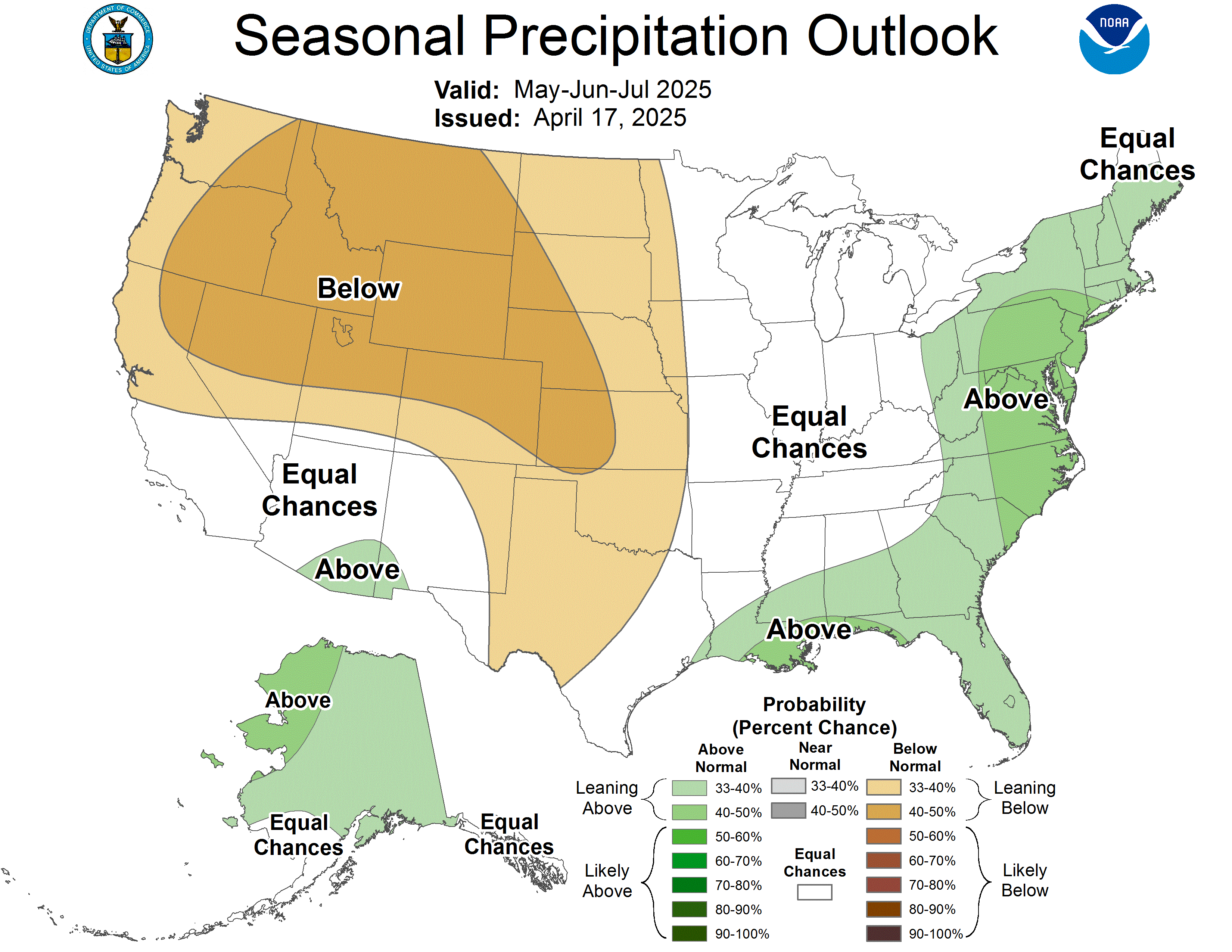
Climate Prediction Center outlooks show the chances of temperatures and precipitation averaging above, near, or below normal for the period shown.
A precipitation probability here is the chance of a wetter- or drier-than-normal period, not the chance of rain on a particular day.
Select this section to load the map, or use the source link below.
Source: NOAA CPC. Tap the map to enlarge. Check its printed issue and valid dates.
Select this section to load the map, or use the source link below.
Source: NOAA CPC. Tap the map to enlarge. Check its printed issue and valid dates.
Select this section to load the map, or use the source link below.
Source: NOAA CPC. Tap the map to enlarge. Check its printed issue and valid dates.
Select this section to load the map, or use the source link below.
Source: NOAA CPC. Tap the map to enlarge. Check its printed issue and valid dates.
Select this section to load the map, or use the source link below.
Source: NOAA CPC. Tap the map to enlarge. Check its printed issue and valid dates.
Select this section to load the map, or use the source link below.
Source: NOAA CPC. Tap the map to enlarge. Check its printed issue and valid dates.
Select this section to load the map, or use the source link below.
Source: NOAA CPC. Tap the map to enlarge. Check its printed issue and valid dates.
Select this section to load the map, or use the source link below.
Source: NOAA CPC. Tap the map to enlarge. Check its printed issue and valid dates.
Maps are supplied by the listed providers. Issue times and forecast periods appear on the graphics or source pages.